Saint Vincent and the Grenadines Country Profile
Key Facts of Saint Vincent and the Grenadines
| Government type: | parliamentary democracy under a constitutional monarchy; a Commonwealth realm |
| Capital: | Kingstown |
| Languages: | English, Vincentian Creole English, French patois |
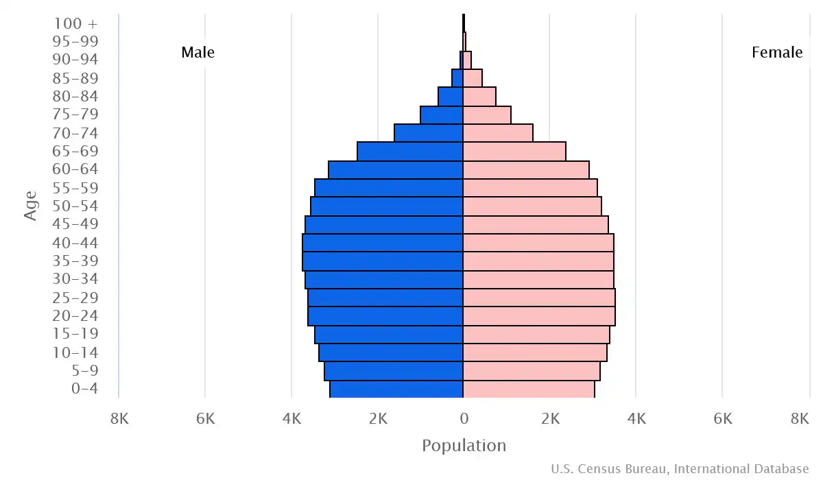
Saint Vincent and the Grenadines Demographic Data
Ethnic Groups in Saint Vincent and the Grenadines(2012 est.)
Religious Groups in Saint Vincent and the Grenadines (2012 est.)
Age pyramid of Saint Vincent and the Grenadines
Saint Vincent and the Grenadines Economy Statistics
Economic overview of Saint Vincent and the Grenadines
upper middle-income Caribbean island economy; key agriculture and tourism sectors; environmentally fragile; diversifying economy across services, science and knowledge, and creative industries; CARICOM member and US Caribbean Basin Initiative beneficiary
Saint Vincent and the Grenadines Real GDP (purchasing power parity) in Billion $
Saint Vincent and the Grenadines Real GDP per capita in $
Saint Vincent and the Grenadines's Exports & Imports in million $
Top 5 Import Partnerin 2022 (67%) of Saint Vincent and the Grenadines
Top 5 Import Commodities in 2022 of Saint Vincent and the Grenadines
- refined petroleum ⛽
- poultry 🍗
- ships 🚢
- raw sugar 🍚
- plastic products ♻️
Top 5 Export Partnerin 2022 (67%) of Saint Vincent and the Grenadines
Top 5 Export Commodities in 2022 of Saint Vincent and the Grenadines
- refined petroleum ⛽
- ships 🚢
- fish 🐟
- shellfish 🐟
- wheat 🌾
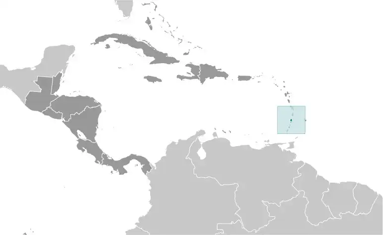
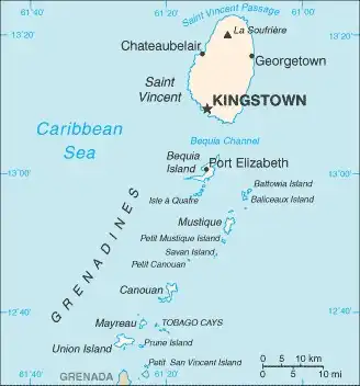
Geography of Saint Vincent and the Grenadines
Map of Saint Vincent and the Grenadines
Land and Water Distrubtion of Saint Vincent and the Grenadines
Natural Resources of Saint Vincent and the Grenadines
- hydropower 💧⚡
- arable land 🌱
Climate inSaint Vincent and the Grenadines
tropical; little seasonal temperature variation; rainy season (May to November)
History of Saint Vincent and the Grenadines - a Summary
Resistance from native Caribs prevented colonization on Saint Vincent until 1719. France and England disputed the island for most of the 18th century, but it was ceded to England in 1783. The British prized Saint Vincent because of its fertile soil, which allowed for thriving slave-run plantations of sugar, coffee, indigo, tobacco, cotton, and cocoa. In 1834, the British abolished slavery. Immigration of indentured servants eased the ensuing labor shortage, as did subsequent immigrant waves from Portugal and East India. Conditions remained harsh for both former slaves and immigrant agricultural workers, however, as depressed world sugar prices kept the economy stagnant until the early 1900s. The economy then went into a period of decline, with many landowners abandoning their estates and leaving the land to be cultivated by liberated slaves.
Between 1960 and 1962, Saint Vincent and the Grenadines was a separate administrative unit of the Federation of the West Indies. Autonomy was granted in 1969 and independence in 1979. In 2021, the eruption of the La Soufrière volcano in the north of Saint Vincent destroyed much of Saint Vincent’s most productive agricultural lands. Unlike most of its tourism-dependent neighbors, the Vincentian economy is primarily agricultural.