South Georgia and the South Sandwich Islands Country Profile
Key Facts of South Georgia and the South Sandwich Islands
| Government type: | - |
| Capital: | - |
| Languages: | - |
South Georgia and the South Sandwich Islands Demographic Data
South Georgia and the South Sandwich Islands Economy Statistics
Economic overview of South Georgia and the South Sandwich Islands
-South Georgia and the South Sandwich Islands Real GDP (purchasing power parity) in Billion $
no data
South Georgia and the South Sandwich Islands Real GDP per capita in $
No data
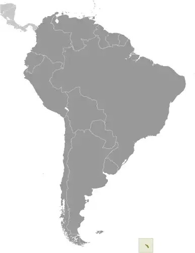
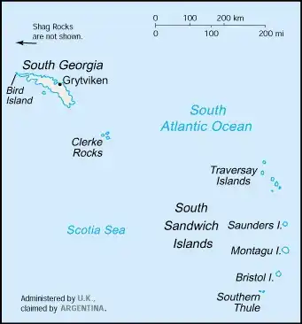
Geography of South Georgia and the South Sandwich Islands
Map of South Georgia and the South Sandwich Islands
Land and Water Distrubtion of South Georgia and the South Sandwich Islands
Natural Resources of South Georgia and the South Sandwich Islands
- fish 🐟
Climate inSouth Georgia and the South Sandwich Islands
variable, with mostly westerly winds throughout the year interspersed with periods of calm; nearly all precipitation falls as snow
History of South Georgia and the South Sandwich Islands - a Summary
South Georgia and the South Sandwich Islands lie approximately 1,000 km east of the Falkland Islands and have been under British administration since 1908 -- except for a brief period in 1982 when Argentina occupied them. Grytviken, on South Georgia, was a 19th- and early 20th-century whaling station. Famed explorer Ernest SHACKLETON stopped there in 1914 en route to his ill-fated attempt to cross Antarctica on foot. He returned some 20 months later with a few companions in a small boat and arranged a successful rescue for the rest of his crew, which was stranded off the Antarctic Peninsula. He died in 1922 on a subsequent expedition and is buried in Grytviken. Today, the station houses scientists from the British Antarctic Survey. Recognizing the importance of preserving the marine stocks in adjacent waters, the UK extended the exclusive fishing zone in 1993, from 12 nm to 200 nm around each island.