World Map
Below, you will find an interactive political world map with the names of all countries & territories with borders. Scroll over the map to zoom in and get closer. Hover the country to show its name and click on it to explore the country’s profile with demographic, economic, geographic data, and more presented in a beautifully designed dashboard.
Interactive World Map
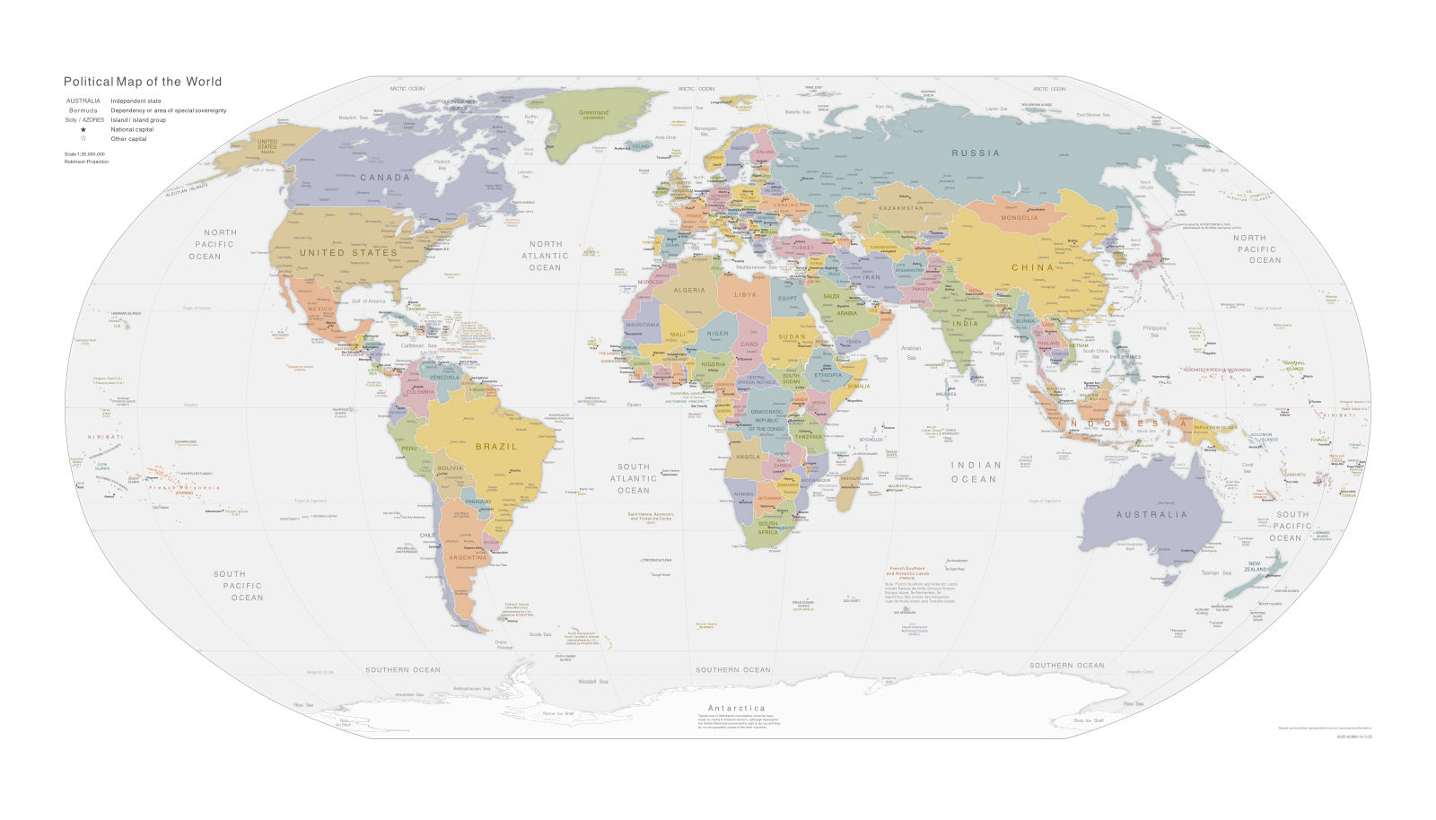
Political Map of the World
Click on the map to view it in full size as a PDF and to download it.
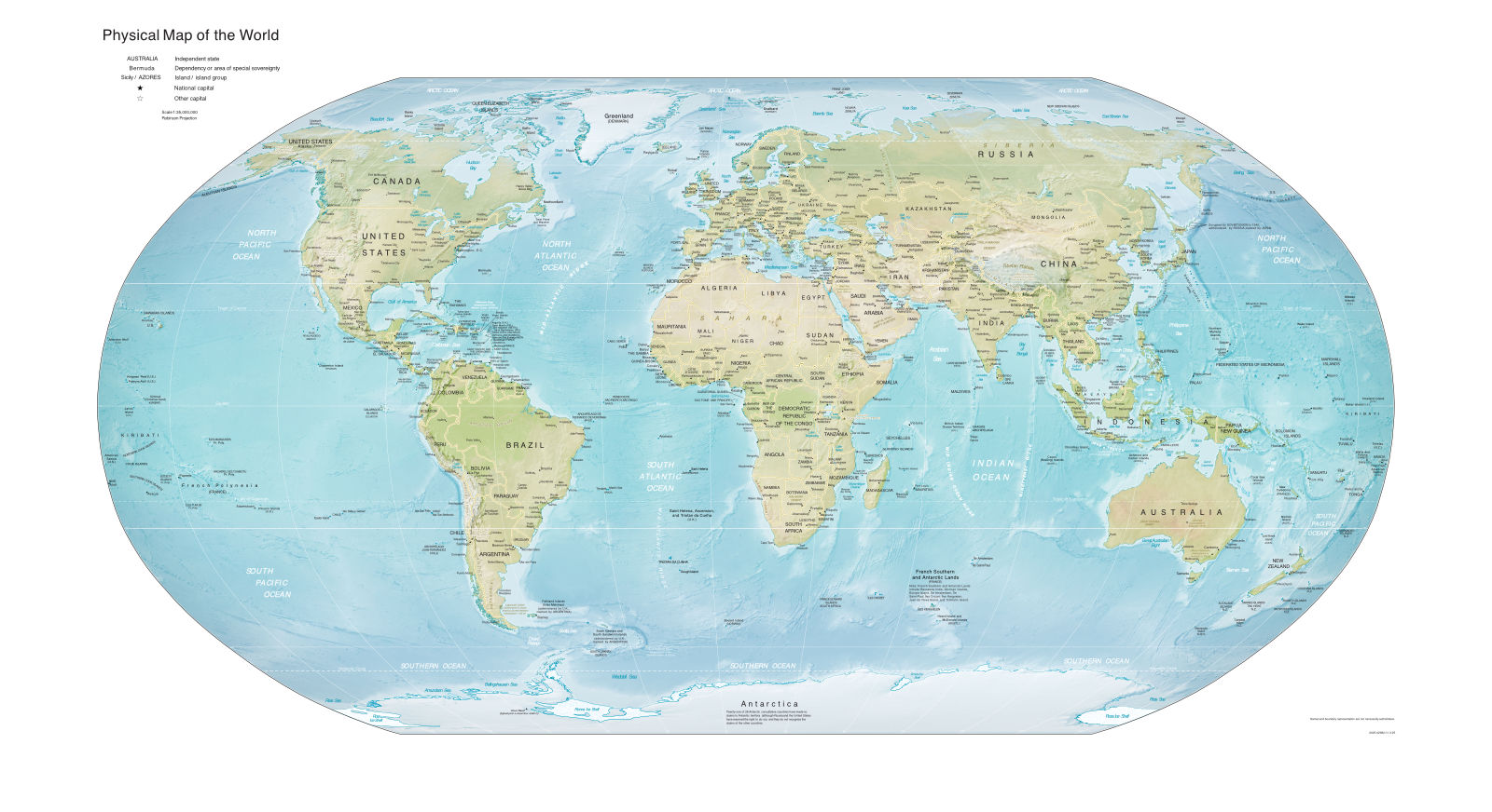
Physical World Map
Click on the map to view it in full size as a PDF and to download it.
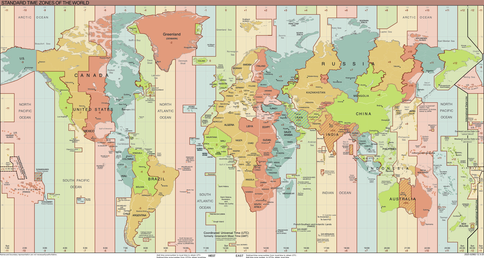
World Map with Standard Time Zones
Click on the map to view it in full size as a PDF and to download it.
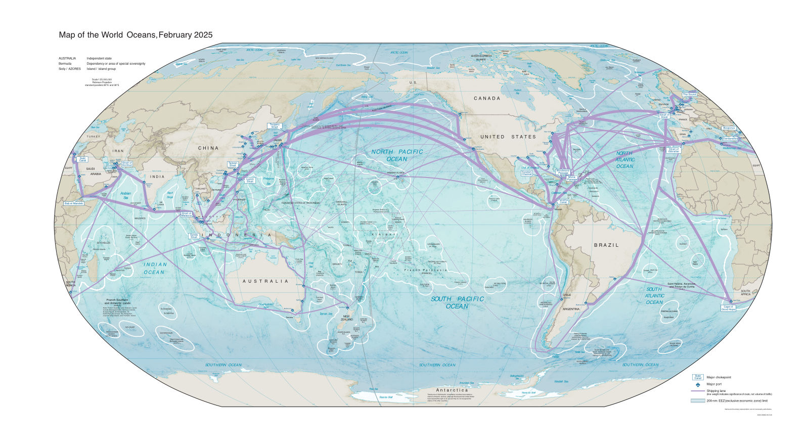
Map of the World Oceans
Click on the map to view it in full size as a PDF and to download it.
Check out our world maps quiz, to test your knowledge of country maps from all around the world.